ESSO - Indian National Centre for Ocean Information Services
(An Autonomous Body under the Ministry of Earth Sciences, Govt. of India)
OTGA-INCOIS Training Course
on
"Coastal Vulnerability Mapping and analysis using QGIS"
during November 20-24, 2023.
Organized by
International Training Centre for Operational Oceanography (ITCOocean)
ESSO-INCOIS, Hyderabad, India
Geospatial science provides vital information on the sustainable use of the coastal resource and planning. It an imperative use such techniques for managing densely populated coastal environs. This course provides an overview of GIS applications pertaining to coastal vulnerability and analysis. It will provide the basic GIS mapping techniques on storm surge vulnerability, and its socio-economic impact using open source GIS tools. Course also includes data acquisition, processing, analysis and interpretation of coastal spatial data. In addition, extensive hands on sessions will be conducted to use tools for preparation of thematic base maps for coastal vulnerability due to Tsunamis, Storm surges and their impact.
- To Provide an introduction to GIS for marine applications
- Utilization of open source spatial data
- To provide hands on GIS applications pertaining to coastal vulnerability (Storm surges) using open source GIS tools
- Generation of Coastal Vulnerability and their socio-economic Impact map
- Knowledge on understanding of spatial data: raster and vector models
- Core tasks involved in the GIS analysis process including data acquisition, management, manipulation and analysis, and presentation and output.
- Use of QGIS, GRASS tools and Plug-in tools
- Creating and editing spatial data.
- Basic understanding of coastal and marine GIS data applications.
- Mr. R. S. Mahendra
- Mr. N. Kiran Kumar
- Dr. N. Srinivasa Rao
- Dr. Prakash C Mohanty
- Mr. H. Shiva Kumar
- Mr. V. Chandra Sekhar
- Mr. Gaurav Bapurao
- Ms. Gautami Ganga
- Ocean and coastal data managers .
- Staff and researchers working on marine GIS applications.
- University graduates.
- Candidates should have a working knowledge of marine data and formats and preferably be working in institutions responsible for the management of marine data.
- This training course is not an introduction to GIS so candidates are expected to have some previous experience in the use of GIS.
- Working knowledge of English.
- Participants should preferably bring their own laptops.
- OTGA India Regional Training Centre Coordinator: Dr TVS Udaya Bhaskar (itcoocean@incois.gov.in)
- OTGA Secretariat: ioc.training@unesco.org
- www.ioc-cd.org
- www.oceanteacher.org
- www.oceanexpert.org
- http://www.incois.gov.in/portal/ITCOocean.jsp
Target audiences include, but are not limited to, the following:
Course Pre-requisites :
A certificate of participation will be issued to all successful students (90% attendance to the classroom course mandatory).
The UNESCO/IOC Project Office for IODE is certified as a Learning Services Provider (ISO 29990:2010).
The OceanTeacher Global Academy is a Project of IOC/IODE supported by the Flanders-UNESCO Trust Fund (FUST) of the Government of Flanders, Belgium.
Course Dates :
20-24 November 2023
Duration:
5 working days (~ 30 hours classroom sessions, plus eventual online assignments)
Period for Applications:
15 August – 20 September, 2023
Application Process :
A limited number of seats (30) is available.Please fill the online application form:https://otga.wufoo.com/forms/zkb8vbi0spv0y1/The deadline to submit the application is 15 September 2023 (23:59 CET: Central European Time). There are no tuition fees.
UNESCO is committed to promote equal access principles. Applications from minority or underrepresented groups are strongly encouraged.
A limited number (up to 5 seats depending on costs) of fellowships for international participants is available (partial or in full). For international participants requesting financial support (full or partial), a dully signed endorsement letter from the institution where the applicant is working is mandatory, to be uploaded on the online application form (email not accepted). Failure to submit it will imply automatic exclusion.
For more detailed information on how to apply here:
No tuition fee applies. A limited number of fellowships is available.
Contacts :
always using as the email subject line the OTGA/INCOIS Training Course: Coastal Vulnerability Mapping and analysis using QGIS Training Course 20-24 November 2023
Useful sites:
Agenda / Programme
|
Time |
Day-1 |
Day-2 |
Day-3 |
Day-4 |
Day-5 |
|
|
Inauguration and Coastal Vulnerability using Remote Sensing and GIS |
Basics of Remote Sensing |
Geospatial Technologies and WebGIS Applications |
GIS - practical |
Practical- Shoreline Change Analysis. |
|
|
|
||||
|
|
Introduction to Operational Ocean Services of INCOIS |
GIS - practical |
Practical -pre processing and Image classification |
Practical- Tsunami Vulnerability Mapping |
Practical- Storm Surge Vulnerability Mapping |
|
|
|
||||
|
|
Basics of GIS |
Image Processing |
Practical -pre processing and Image classification |
Extraction of Shorelines using Geospatial Techniques |
Group Presentation and Evaluation |
|
|
|
||||
|
|
Basic GIS practicals (QGIS Basics) |
GIS - practical |
Introduction and data analysis with Google Earth Engine |
Visit to INCOIS Facilities |
Validatory and Closing |
|
|
Discussion on day 01 proceedings, Q&A |
Discussion on day 02 proceedings, Q&A |
Discussion on day 03 proceedings, Q&A |
||
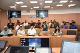
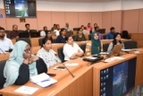
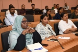
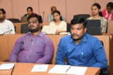
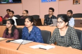
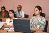
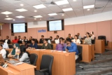
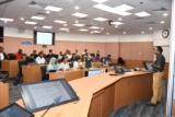
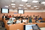
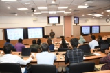
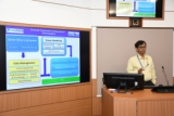
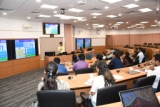
Photo Gallery