ESSO - Indian National Centre for Ocean Information Services
(An Autonomous Body under the Ministry of Earth Sciences, Govt. of India)
INCOIS Online Oil Spill Advisory (OOSA) Ver 4.0
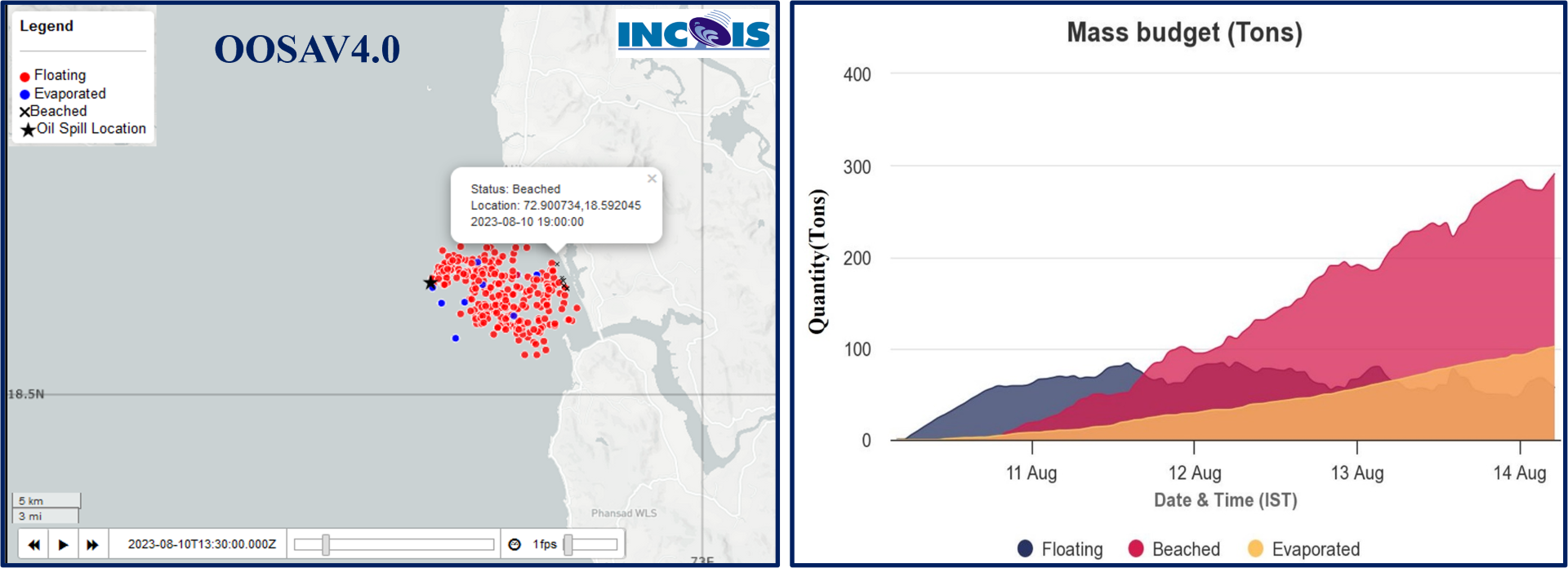
INCOIS OOSA V4.0 is an integrated set up of oil spill trajectory model, General ocean circulation models, atmospheric models and Geographical Information System (GIS). v4.0 has the better representation of oil drift patterns in web map services. The user can generate the oil drift patterns within the domain 60E to 100E, 0N to 25N. The users can interpret the trajectory patterns using the video/play options provided. The quantitative status of the spilled oil pollutant is now made available for the users in the form of graphs.